As the clouds gather and Ohio heads into its unpredictable severe weather season, a new tower stands tall near the wetlands of the Ohio State Lima campus just off Thayer Road.
A state-of-the-art Mesonet station has officially joined the ranks of Ohio’s growing weather network, promising to improve forecasting and weather prediction for farmers, families and emergency responders alike.
Bridging the radar hole
For years, a silent challenge has loomed over northwest Ohio. Despite our advanced technology, cities like Lima and Findlay sit in the equivalent of a radar hole. Because of the distance from major National Weather Service hubs, traditional radar often beams over the top of the action, failing to detect what is happening below 3,000 feet.
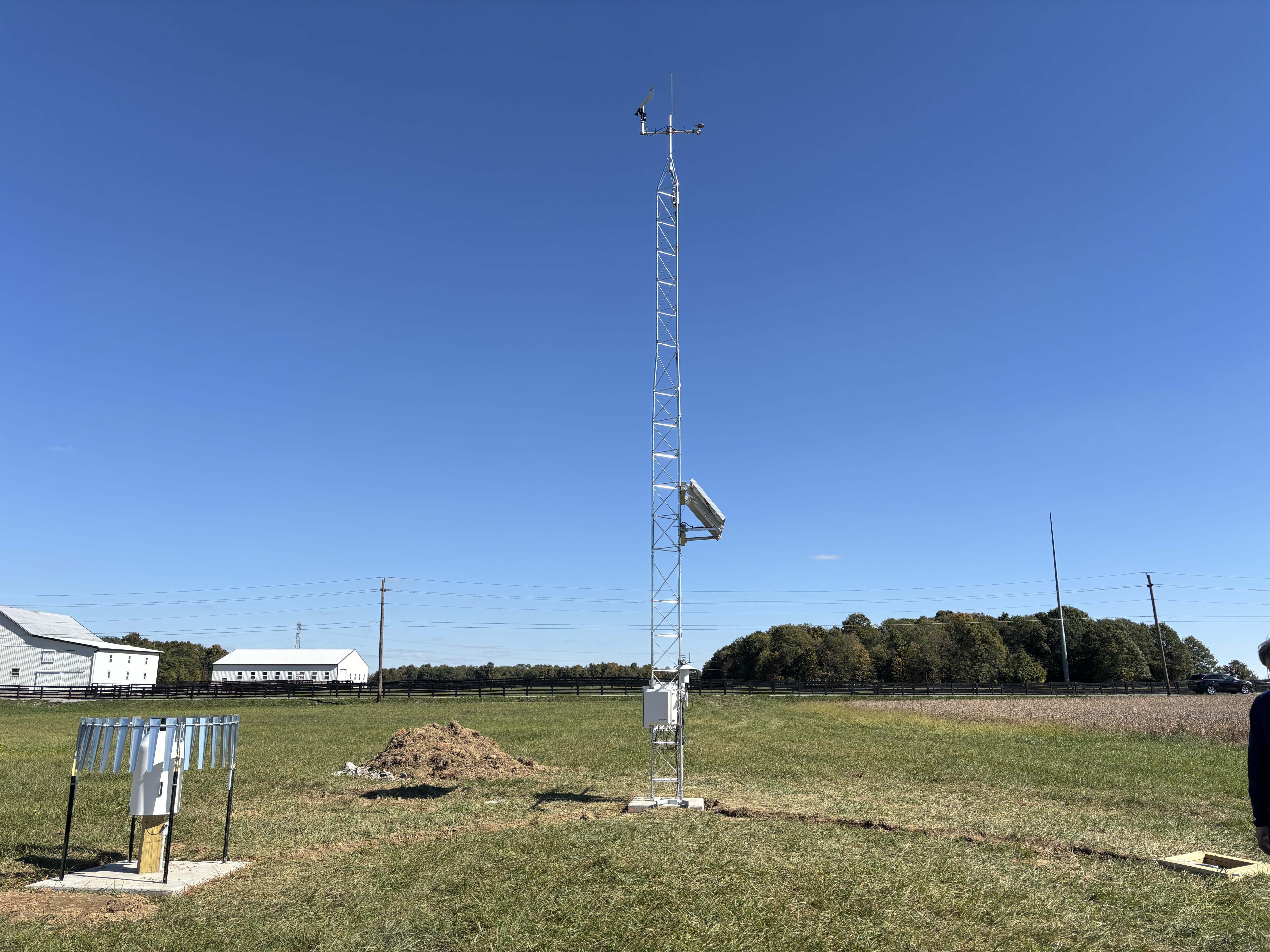
The new Lima station and the network it belongs to begins to change the game. It captures high-quality data every five minutes. While a lone station will only make a marginal difference in forecasts, as the network grows more dense across the state, hazardous condition warnings will improve in accuracy and timeliness.
“There are benefits to the community in terms of public safety as this station will provide environmental information to organizations involved in emergency management like the National Weather Service and Ohio EMA that is accurate, conforms to world standards for meteorological measurements and is in near real time,” said James DeGrand, Mesonet manager at Ohio State. “While this benefit is likely not that significant for just one station, it becomes much more significant as the size of the network grows.”
The perfect patch of land
Finding the perfect home for a weather station is no easy feat. To get strong, clean data, sensors must be at least 325 feet away from artificial surfaces like buildings or sizzling parking lots.
The search led straight to the Ohio State Lima wetlands area, a site that offered both the space and the stability needed without taking land out of production.
“The site we picked at Lima works well for us,” DeGrand said. “It's almost 100 m from the road and the nearest building is more than 120 m away. Importantly, it is not likely to be the site of future development so we can expect the station environment to remain stable for the foreseeable future which is important for building a climate record for the site.”
Empowering our farmers
While the station protects the whole community, its most immediate impact will be felt in the furrows of Ohio’s farm fields. Funded by Nationwide Insurance via a grant from Ohio State’s AgTech Innovation Hub, the station is uniquely tailored for agriculture.
“It's always beneficial to have high quality measurements of the standard meteorological variables like wind speed and direction, temperature humidity and rainfall near where you are raising crops and livestock,” DeGrand said. “In addition to these, we are recording information that is really useful to farmers but not commonly available such as soil temperature and moisture at multiple depths and leaf wetness. This will be useful in terms of planting decisions. Also, we have temperature and wind sensors at multiple heights above the surface, and this will help farmers with decisions related to spraying applications.”
A growing network
The Lima station is one of 10 currently strengthening Ohio's defenses, with a goal to eventually place a station in every one of Ohio's 88 counties. This data isn't just for scientists; it’s for everyone. The readings will feed into a public website and national networks, allowing students to use real-world data in their science curricula.
As we head into the stormy months ahead, Lima is no longer just watching the sky. It’s measuring it, understanding it and preparing for whatever the Ohio weather brings.